 vesseltracker.com
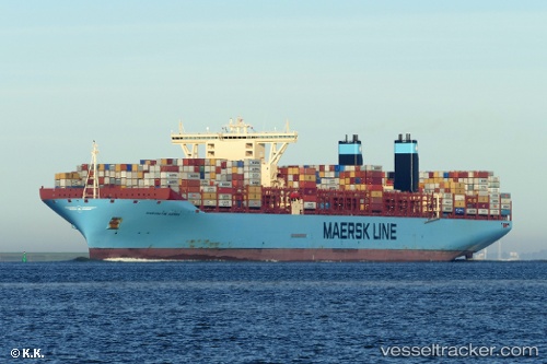
Vessel Margrethe Maersk IMO: 9632131, MMSI: 219629000 Container Ship
UTC, -20.33510, 4.51768, course: 323, speed: 19.9
UTC, -19.96178, 4.21357, course: 322, speed: 20.1
2026-03-12 20:23:09 UTC, -19.18095, 3.58968, course: 323, speed: 20.2
Live Vessel Margrethe Maersk Analytics (details, animations, etc.)
Live AIS position: UTC. Open sea (no nearby ports in database)), updated 2026-03-12 20:23:09 UTC.Find the position of the vessel Margrethe Maersk on the map. The latter are known coordinates and path.
marine traffic ship tracker show on live map
The current position of vessel Margrethe Maersk is -19.18095 lat / 3.58968 lng. Updated: 2026-03-12 20:23:09 UTCDetails:
Last coordinates of the vessel:
UTC, -20.96148, 5.01210, course: 324, speed: 20.1UTC, -20.33510, 4.51768, course: 323, speed: 19.9
UTC, -19.96178, 4.21357, course: 322, speed: 20.1
2026-03-12 20:23:09 UTC, -19.18095, 3.58968, course: 323, speed: 20.2